top of page
Surveyors Equipment

Surveyor, Architect, & Engineer Solutions

Transforming Concepts into Precise Reality Through Advanced Photogrammetry and GIS Expertise

Our services encompass 3D modeling, mesh generation, and Geographic Information Systems (GIS) expertise. Seamlessly integrating GIS, we offer dynamic spatial analysis and visualization, enhancing your project's efficiency and impact.

Architect on Building Site

Services Offered

Imagery Processing & Analysis

  • 2D orthomosaics, 3D models, spatial measurements, and site maps, allowing for easy assessment of inventory.

Customized Reporting and Documentation

  • Our reports are tailored to meet the specific requirements of your decision-making projects. Through visualizations, maps, charts, and detailed interpretations, we present the information in a clear and concise manner.

Consulting & GIS Solutions
free 1 hour

  • Provide consulting services to operation managers of all types, helping them implement GIS solutions, optimize their operations, and train their staff.

Subscription-based Solutions
prices vary per project

  • Subscription-based consulting that provides ongoing data analysis, storage and other services for Surveyors, Architects, and Engineers.

Solution Applications

Surveyor Applications

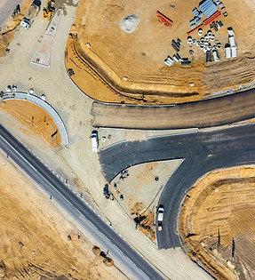
  • High-resolution orthomosaic with accurate georeferencing ready for precise analysis and measurement.

  • Aerial Survey Imagery with contour maps, feature measurements, and geospatial data for land boundaries, elevations, and topographic features can be included. (visit our dedicated spatial analysis page for more)

  • Topographic Mapping: Gain comprehensive insights into the terrain and elevation of a site, aiding in project planning and design.

  • Construction Site Monitoring: Monitor construction progress and site changes over time, enhancing project management.

  • Volume Calculations: Precisely measure earthwork volumes for construction projects, optimizing resource allocation.

Architect Applications

  • 3D Modeling for Architectural Visualization: Transform architectural concepts into lifelike 3D models, enabling clients to envision designs.

  • Site Analysis: Analyze site conditions, including factors like sunlight, wind patterns, and accessibility, to inform design decisions.

  • Historical Preservation Documentation: Create detailed records of historical structures through 3D modeling, aiding in restoration efforts.

Engineer Applications

  • Infrastructure Monitoring: Monitor the health and stability of infrastructure like bridges and dams using accurate 3D models.

  • Corridor Mapping: Create detailed maps of linear features such as roads, railways, and pipelines for efficient design and maintenance.

  • Environmental Impact Assessment: Evaluate the environmental impact of projects through spatial analysis, aiding regulatory compliance.

  • Geotechnical Analysis: Analyze subsurface conditions and soil properties to inform foundation design and mitigate risks.

Picture1.png
Minimalist Project Management Process Infographic Graph (1).jpg

Benefits of Data Processing & GIS Solutions for Surveyors, Architects, & Engineers

Benefit 1: Enhanced Accuracy and Precision

Photogrammetry and GIS technologies provide a level of accuracy and precision that traditional methods often struggle to achieve. In surveying, precise measurements are critical for property delineation and construction planning. Architects benefit from accurately visualizing their designs, ensuring a seamless transition from concept to reality. Engineers rely on accurate data for structural analysis and risk assessment. These technologies enable professionals to make informed decisions with confidence, minimizing errors and reducing costly revisions.

​

Benefit 2: Efficient Project Planning and Design

In all three industries, the ability to quickly generate accurate 3D models and geospatial data streamlines project planning and design phases. Surveyors can rapidly create topographic maps, architects can visualize their designs in realistic detail, and engineers can optimize infrastructure layouts. This efficiency translates into time savings, allowing for faster project iterations and quicker decision-making. As a result, projects move from conception to execution more smoothly, saving both time and resources.

​

Benefit 3: Informed Decision-Making

Photogrammetry and GIS services empower professionals with comprehensive data insights. Surveyors gain a deeper understanding of land characteristics, helping them identify potential challenges before construction begins. Architects use site analysis data to make design choices that align with environmental conditions. Engineers assess various factors such as environmental impact and geotechnical conditions before commencing a project. These insights lead to better-informed decisions that mitigate risks and enhance project outcomes.

​

Benefit 4: Effective Communication and Visualization

Visual representations play a crucial role in conveying complex information to stakeholders. Photogrammetry generates detailed 3D models that architects can use to showcase their designs. Engineers use geospatial data to create visualizations that illustrate project impacts. Surveyors can present boundary surveys in an easily understandable format. These visual tools foster effective communication, allowing clients, regulators, and team members to grasp project details more intuitively. This enhances collaboration and ensures everyone is on the same page throughout the project lifecycle.

Learn more how Spatial Technology is impacting your Industry!

Speak with an Specialist

Harness the power of spatial data analysis and interpretation to drive informed decision-making. Contact us today to discuss your needs and discover how our expertise can help you unlock the valuable insights within your spatial datasets.

What is GIS?

GIS, or Geographic Information Systems, is a technology that enables the capture, storage, manipulation, analysis, and presentation of geographically-referenced data. 

What is Photogrammetry?

Photogrammetry is the science of extracting measurements from photographs.

bottom of page