top of page
Maps

Spatial Analysis & GIS Services

Navigating the world with precision through Spatial Analytics & GIS technology

In an increasingly interconnected world, harnessing the power of geographic information systems (GIS) and advanced spatial analysis has become indispensable for informed decision-making and problem-solving. Whether you are seeking to optimize resource allocation, analyze patterns, or gain a deeper understanding of spatial relationships, we are here to navigate the terrain of spatial analysis with precision and deliverables that drive innovation. 

Advanced Spatial Analysis & GIS Services

prices vary per project

  • Volume and Height Calculations, Cross-sectional Profiles, and Data Modeling

  • Property Mapping, Boundary Maps, and Contour Maps

​​

From meticulous volume and height calculations to intricate cross-sectional profiles, our advanced data modeling expertise empowers data-driven decision-making. 

Picture3.png
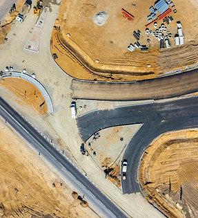
New Town

Development & Planning GIS Solutions

Elevating Projects with Precision: Your Vision Transformed Through Innovative GIS Solutions

Our comprehensive GIS solutions seamlessly integrate spatial data, advanced mapping, and data analytics, empowering you to make informed decisions at every project phase. By leveraging the spatial intelligence offered by GIS, you can enhance project coordination, streamline resource allocation, minimize environmental impact, and ensure regulatory compliance.

Types of Services

GIS Consulting Solutions
Free 1 hour / prices vary per project

  • Provide consulting services to developers and planners, helping them implement GIS solutions, optimize their operations, and train their staff.

Data Analysis, Interpretation, & Reporting
prices vary per project

  • Gather and analyze data from GIS systems to provide actionable insights to clients, helping them make informed decisions about site selection, urban planning, and infrastructure development.

Subscription-based Solutions
prices vary per project

  • Subscription-based consulting that provides ongoing data analysis and other planning services for operation managers and developers.

Travel planning
City Garden

Solution Applicaitons

Infrastructure Development

  • GIS tools can model infrastructure networks, optimize utility placements, and assess potential risks like flood zones or geological hazards.

Urban Planning & Design

  • Urban planning encompasses creating comprehensive blueprints for sustainable city growth, encompassing land use, transportation networks, infrastructure placement, and public spaces.

Site Selection & Analysis

  • GIS can assist by creating maps that display demographic data, transportation networks, existing infrastructure, and environmental constraints. 

Risk Assessment

  • GIS can be used to assess risk factors such as road conditions and environmental hazards, aiding in city planning and decision-making.

Aerial View of Distribution Center

Logistics & Trucking GIS Solutions

Navigating Logistics with Precision: Your GIS Partner for Success.

From route optimization and data analysis to last-mile delivery and warehouse management, our tailored GIS solutions are designed to enhance efficiency, reduce costs, and ensure timely deliveries. We offer consulting, data analysis, and training to empower your logistics business for success.

Types of Services

GIS Consulting Solutions
Free 1 hour / prices vary per project

  • Provide consulting services to logistics companies, helping them implement GIS solutions, optimize their operations, and train their staff.

Data Analysis, Interpretation, & Reporting
prices vary per project

  • Gather and analyze data from GIS systems to provide actionable insights to clients, helping them make informed decisions about route planning, fleet management, and resource allocation.

Subscription-based Solutions
prices vary per project

  • Offer subscription-based GIS platforms that provide ongoing route optimization and other logistical services to trucking companies.

Aerial View of Containers
White Van

Solution Applicaitons

Route Optimization

  • GIS helps trucking companies optimize routes by considering factors like traffic congestion, road closures, weather conditions, and delivery schedules. This reduces fuel costs, improves efficiency, and minimizes delays.

Warehouse Management

  • GIS assists in warehouse location selection, layout planning, and inventory management. It helps streamline the movement of goods within warehouses and between distribution centers.

Last-Mile Delivery

  • GIS helps plan and optimize last-mile deliveries, ensuring that goods reach their final destinations with minimal delays and costs.

Risk Assessment

  • GIS can be used to assess risk factors such as road conditions, crime rates, and environmental hazards, aiding in route planning and decision-making.

Court Room

Attorney & Firm GIS Support

Legal Terrain with Geospatial Insight: Your Trusted Attorney & Firm GIS Support Partner

We offer a comprehensive suite of GIS solutions tailored specifically for environmental, cultural, and natural resource cases. Visualize data trends, present evidence effectively, and make informed decisions based on location-based insights. 

Types of Services

Consulting & GIS Mapping Solutions
minimum $150 per map

  • Provide consulting services to attorneys of all types, helping them implement GIS solutions, optimize their operations, and train their staff.

Data Analysis, Interpretation, & Storage
prices vary per project

  • Gather and store data from GIS systems to provide actionable insights to clients, helping them with property maps and visual representations of spatial data.

Subscription-based Solutions
prices vary per project

  • Subscription-based consulting that provides ongoing data analysis, storage and other services for various firms.

Judge and Gavel
Horse Grazing

Solutions Offered

  • Spatial Analysis: Collect and integrate data sources such as air quality measurements, soil samples, water quality data, and health records into a GIS system.

  • Environmental Mapping: Create thematic maps that visualize pollution levels, contamination sources, and affected areas. Use color-coded maps to show the concentration gradient of pollutants.

  • Hotspot Identification: Identify pollution hotspots and areas with higher health risks. Overlay population density data to assess potential impacts on vulnerable communities.

  • Temporal Analysis: Use time-series data to show the evolution of pollution levels over different time periods. This can help demonstrate the correlation between industrial activity and environmental degradation.

  • Buffer Analysis: Create buffers around the facility to show the proximity of pollution sources to residential areas, schools, and other sensitive locations. Use buffers to indicate legal riparian zones and assess potential infringement by neighboring property owners.

  • 3D Visualization: Develop 3D visualizations of pollution plumes, showcasing the dispersion patterns and potential spread of pollutants over time.

  • Flow Visualization: Generate flow direction maps to illustrate the natural water movement and potential points of diversion.

  • Flow Accumulation Analysis: Calculate flow accumulation along the stream to identify areas where water is naturally concentrated, supporting arguments about the impact of diversion.

Applications & Outcomes

Scenario 1: By providing scientific evidence of water flow and diversion, the GIS analysis helps the attorney present a well-founded case to protect the farmer's water rights and demonstrate the impact of the alleged water diversion on their irrigation practices.

​

Scenario 2: By providing comprehensive spatial data analysis and visualizations, the GIS services support the attorney in presenting a strong case demonstrating the adverse effects of the industrial facility on the community's environment and health.

Inside Greenhouse
Minimalist Project Management Process Infographic Graph (1).jpg

Benefits of Spatial Analysis & GIS Services

Benefit 1: Enhanced Decision-Making

Harnessing the power of spatial analysis and GIS expertise brings a multitude of benefits across various industries. By visualizing and analyzing data in a geospatial context, organizations gain valuable insights for informed decision-making. Whether it's optimizing supply chain routes, identifying ideal store locations, or planning urban development, spatial analysis empowers businesses to make smarter, data-driven choices that maximize efficiency and effectiveness.

​

Benefit 2: Improved Resource Allocation

Spatial analysis and GIS services enable industries to optimize resource allocation by understanding geographic patterns and relationships. Whether it's managing natural resources, planning infrastructure projects, or allocating emergency response services, the ability to analyze spatial data empowers organizations to allocate resources more effectively, reducing costs and improving operational outcomes.

​

Benefit 3: Enhanced Environmental Management

Spatial analysis plays a crucial role in environmental management across industries. GIS expertise allows for the integration and analysis of environmental data, enabling organizations to assess and monitor natural resources, analyze biodiversity patterns, identify vulnerable ecosystems, and mitigate environmental risks. By leveraging spatial analysis, industries can adopt sustainable practices and make informed decisions that balance economic growth with environmental conservation.

​

Benefit 4: Effective Planning and Risk Mitigation

Spatial analysis and GIS services provide valuable tools for planning and risk mitigation across industries. By modeling and simulating scenarios in a spatial context, organizations can evaluate potential risks, assess their impacts, and develop proactive strategies. From urban planning and disaster management to site selection and transportation route optimization, spatial analysis empowers industries to identify and address potential challenges, reducing risks and increasing preparedness for a more resilient future.

Learn more how Spatial Technology is impacting your Industry!

Speak with a Spatial Analyst

Harness the power of spatial data analysis and interpretation to drive informed decision-making. Contact us today to discuss your consultation needs and discover how our expertise can help you unlock the valuable insights within your spatial datasets.

What is GIS?

GIS, or Geographic Information Systems, is a technology that enables the capture, storage, manipulation, analysis, and presentation of geographically-referenced data. 

What is Photogrammetry?

Photogrammetry is the science of extracting measurements from photographs.

bottom of page