top of page
Construction in Progress

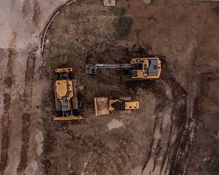
Construction Site Progress Imagery

Track construction progress with precision using our comprehensive drone imagery

Our Construction Site Progress Assessment services provide valuable insights throughout the construction lifecycle, helping you monitor and document the progress of your projects. We offer comprehensive aerial assessments before, during, and after construction, ensuring transparency, quality control, and effective project management.

Construction Site

Construction Site Solutions

Pre-Construction Phase

During the pre-construction phase, your solutions can play a pivotal role in setting the stage for a successful project:

  • Site Assessment and Planning: Utilize drones to capture detailed aerial imagery of the site. This imagery can be transformed into high-resolution maps and 3D models, helping architects, engineers, and planners gain a comprehensive understanding of the terrain, potential obstacles, and opportunities for optimization.

  • Stakeholder Communication: The visual data collected can be shared with stakeholders, architects, and engineers, facilitating effective communication and alignment of project goals.

During Construction Phase

As construction is underway, your solutions can contribute to real-time monitoring and efficient project management:

  • Progress Tracking: Regular drone flights can capture up-to-date images of the construction site. This enables accurate progress tracking, helping project managers identify any deviations and take corrective actions promptly.

  • Quality Control and Issue Detection: High-resolution imagery can highlight construction defects, deviations from the plan, and potential safety hazards. 

  • Inventory Management: Utilize drone technology to monitor stockpile volumes of materials like gravel, sand, and construction aggregates. 

Post-Construction Phase

Once the construction is complete, your solutions continue to provide value in various ways:

  • Project Handover: Provide clients with comprehensive documentation, including interactive 3D models and GIS data, to aid in project handover. This not only demonstrates the project's adherence to specifications but also assists clients in future decision-making.

Pre, During, & Post Orthomosaic Processing & Reporting

  • Side-by-side comparison of orthomosaic maps at different stages of your construction or roofing project, showcasing progress, identifying discrepancies, and providing data-driven insights for project tracking and decision-making.

Construction Site
Service pathway diagram

Benefits of Drone Imagery for Assessing Construction Site Progress

Benefit 1: Enhanced Project Monitoring and Documentation

Using drone footage throughout the construction process allows for comprehensive project monitoring and documentation. The aerial imagery captures the progress and changes over time, providing a visual record for accurate documentation, quality control, and project management purposes.

​

Benefit 2: Improved Site Planning and Design

Drone footage provides valuable insights for site planning and design. It allows construction professionals to gather precise measurements, analyze topography, and identify potential challenges or opportunities in the early stages. This information aids in making informed decisions, optimizing designs, and ensuring efficient resource allocation.

​

Benefit 3: Enhanced Safety and Risk Management

Drones contribute to improved safety and risk management on construction sites. By capturing aerial imagery, they help identify potential hazards, monitor compliance with safety regulations, and assess the overall site condition. This enables proactive measures to mitigate risks, maintain a safe working environment, and prevent accidents.

​

Benefit 4: Effective Communication and Stakeholder Engagement

Drone footage facilitates effective communication and stakeholder engagement throughout the construction process. The visual representation of the project's progress and milestones helps stakeholders, including clients, contractors, and investors, better understand the scope, status, and impact of the construction. It promotes transparency, fosters collaboration, and supports informed decision-making.

Learn more how Spatial Technology is impacting your Industry!

Speak with a Pilot 

By utilizing our Construction Site Progress Assessment services, you gain a comprehensive understanding of your construction projects, enabling informed decision-making, effective communication with stakeholders, and ensuring successful project outcomes.

What is Photogrammetry?

Photogrammetry is the science of extracting measurements from photographs.

What is GIS?

GIS, or Geographic Information Systems, is a technology that enables the capture, storage, manipulation, analysis, and presentation of geographically-referenced data. 

bottom of page